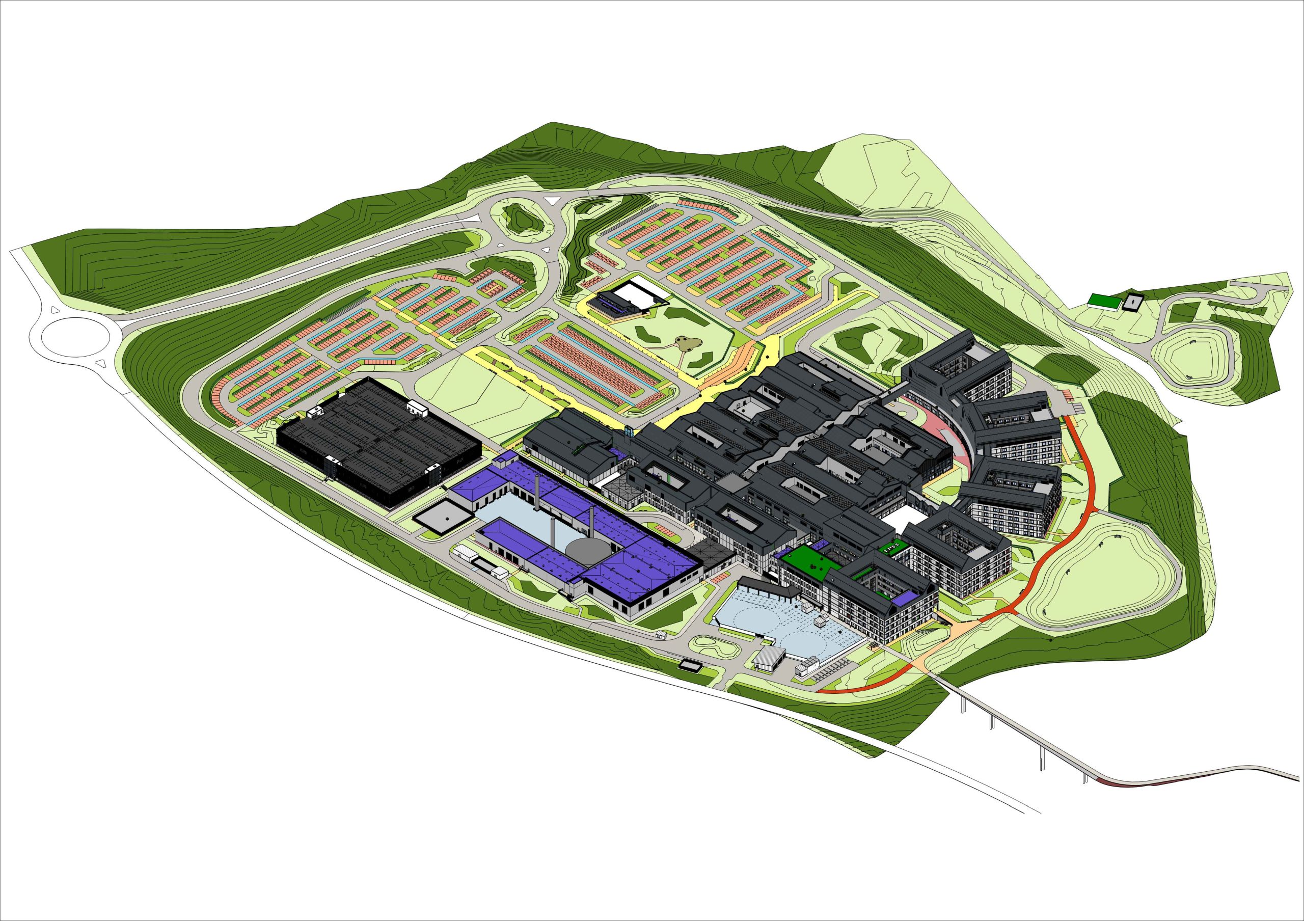
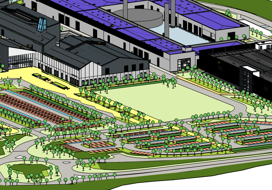
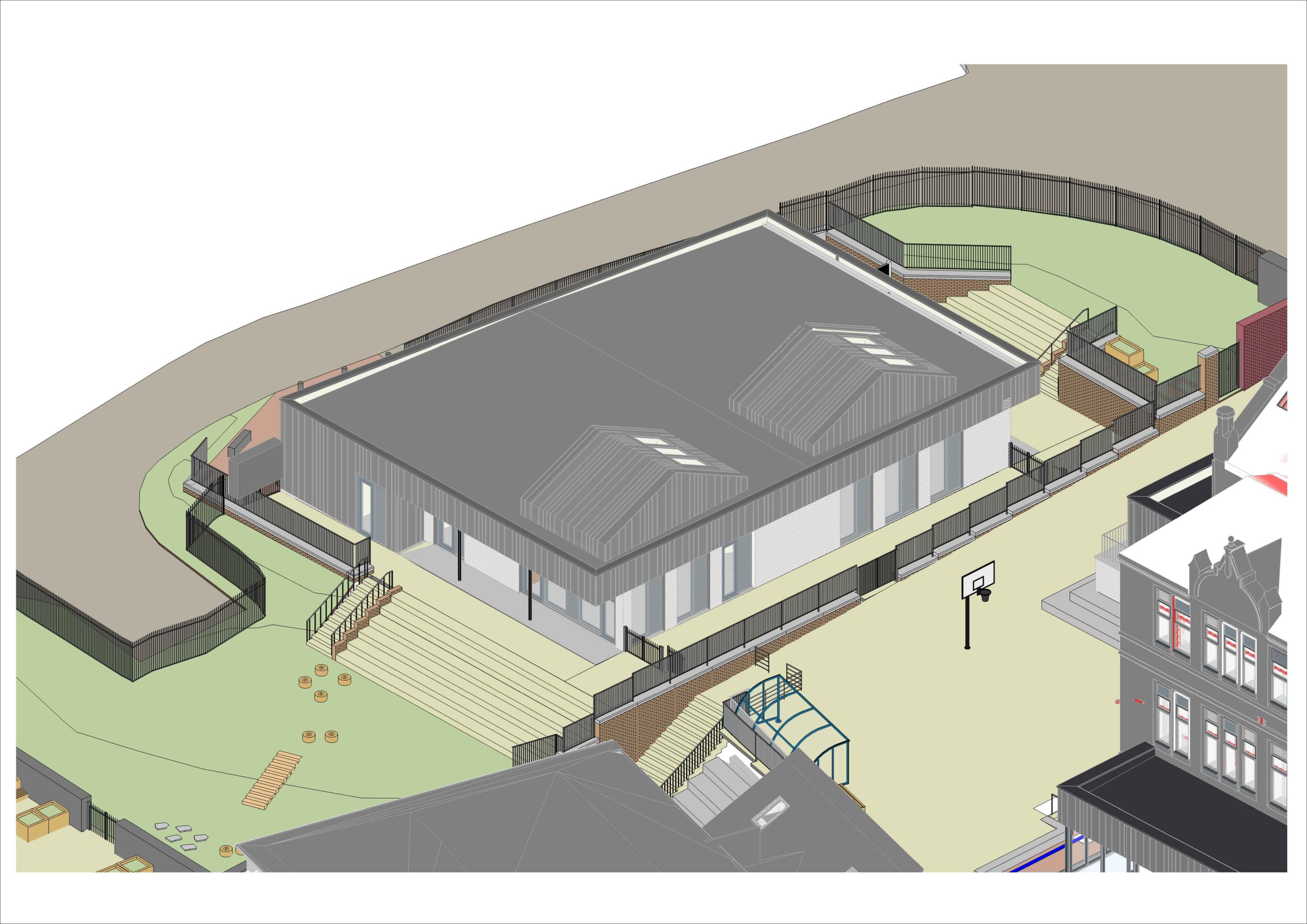
Building Information Modelling
Hirst Landscape Architects are among the industry leaders in Landscape Architecture, utilising Autodesk Revit to meet Building Information Modelling (BIM) standards and requirements on a wide range of projects to produce the required landscape design information.
We can work seamlessly within a multi-disciplinary project BIM Execution Plan (BEP) to create our own landscape model. This can be as part of a federated model environment, or a cloud hosted 3D model on BIM360 & Autodesk Construction Cloud. Drawing outputs are generated from the native Revit model file.
Since introducing Revit to the Practice in 2020, we have continuously utilised our experience and knowledge to develop and refine our internal systems, procedures and internal knowledge sharing. In addition, we have added the Environment for Revit plugin software which enables us to undertake more efficient and accurate Landscape modelling. This adaptation has improved our ability to co-ordinate with Civil Engineering 3D models and enabled us to provide a more accurate representation of site wide levels within Revit.
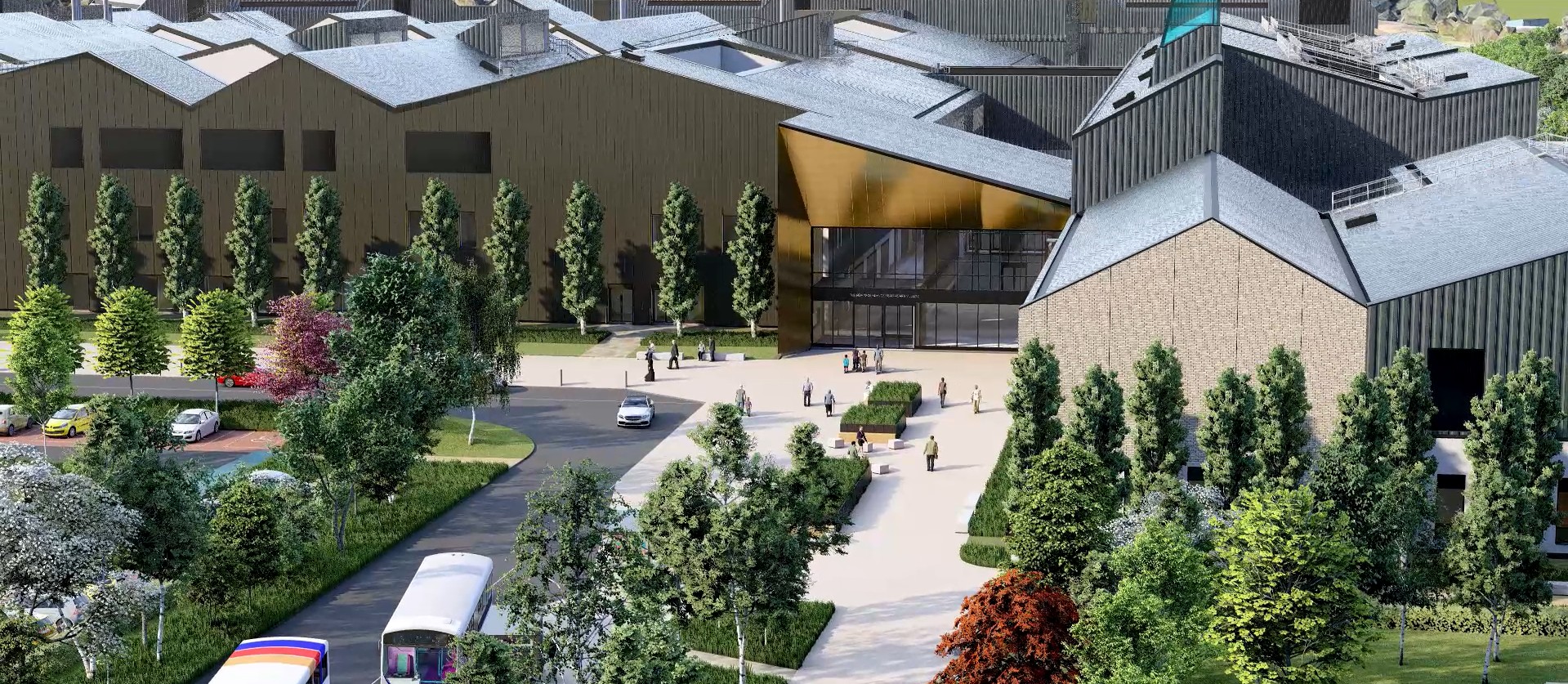
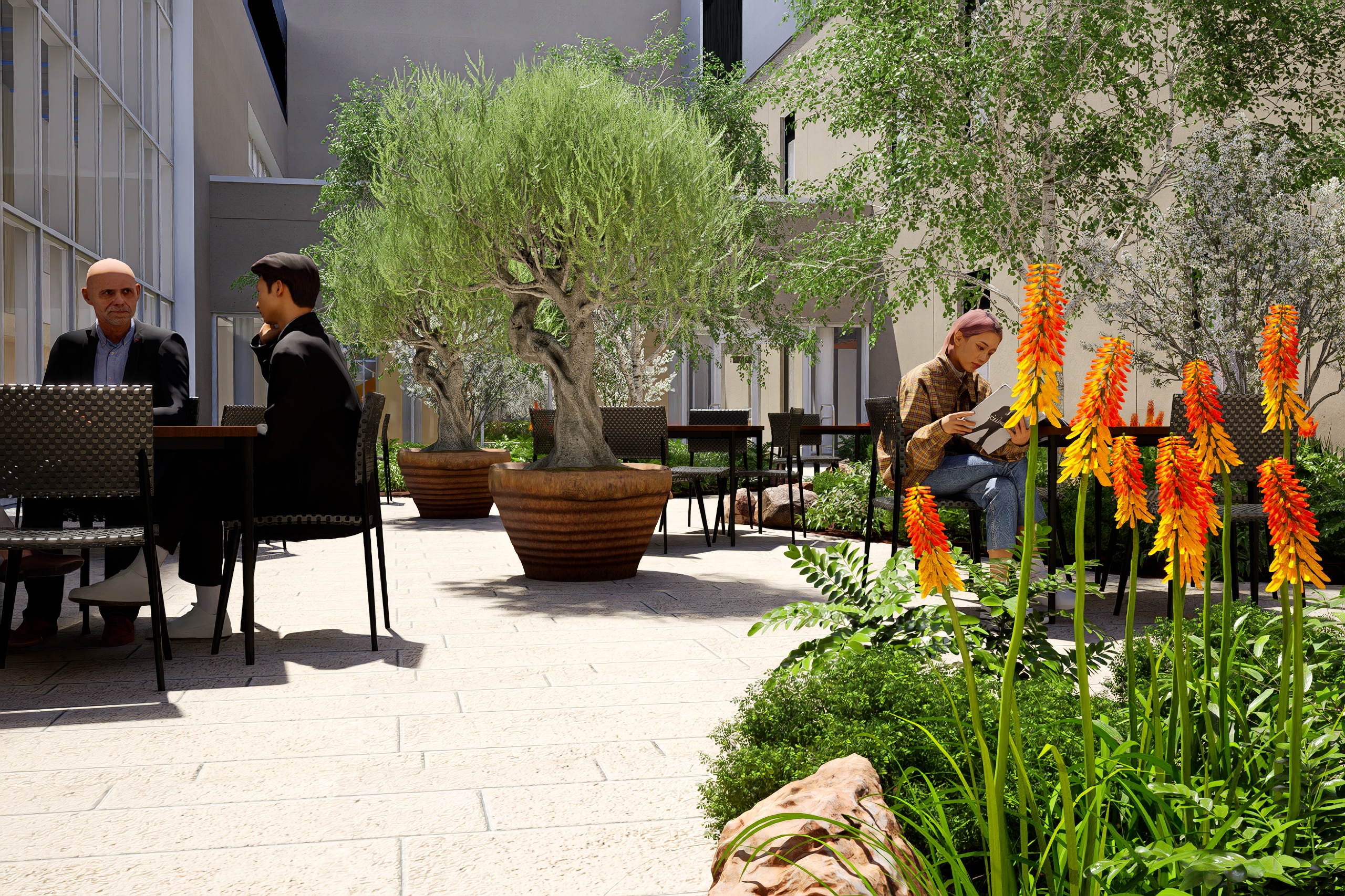
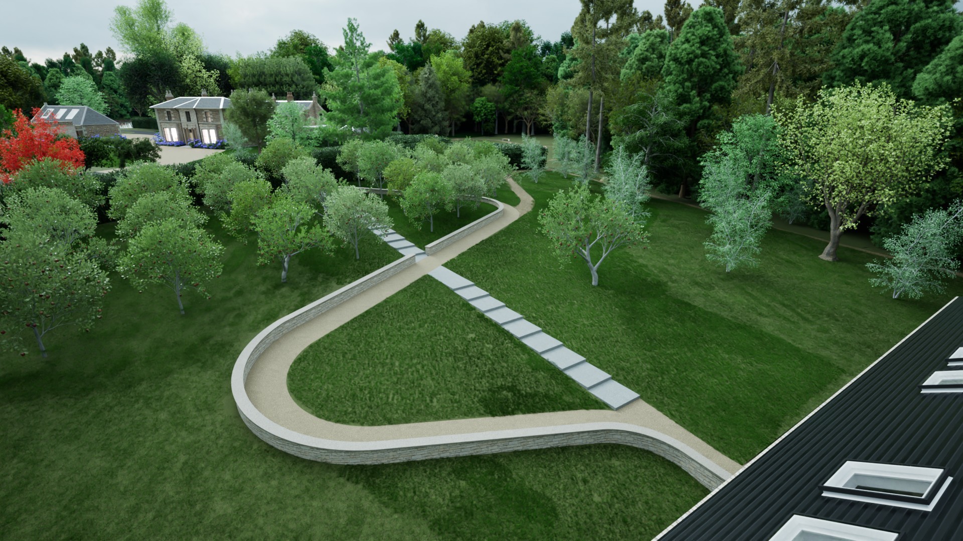
More recently we have extended our capabilities to include 3D rendering for the production of visualisations and flythroughs on larger scale projects.
Our in-house Revit/BIM team at Hirsts have experience in all aspects of BIM including:
- Ensuring compliance with ISO-19650-1:2018 & ISO-19650-2:2018.
- Uploading, collaborating and applying the correct meta-data in a Common Data Environments (CDE) such as BIM 360, Autodesk Construction Cloud and A-site.
- Applying and producing outputs for Classification and COBie data where required.
- Ensuring model information corresponds with the correct Level of Detail (LOD) and Level of Information (LOI) at every project stage.
- Clash Detection using Autodesk Navisworks Manage.
- Producing visualisations and rendered outputs through rendering packages such as Lumion, Twinmotion and D5 Render.